A Glencoe Emergency in the Scottish Highlands

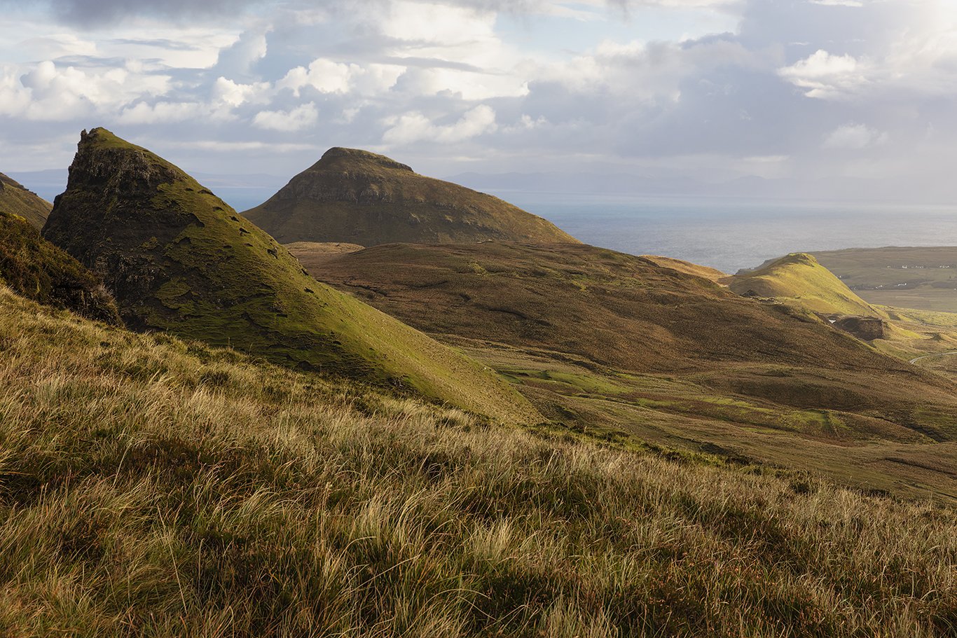
We’ve taken the ferry from the Isle of Lewis and Harris to the mainland of the Scottish Highlands. It is time to explore Glencoe, a village situated in the steep-sided Glencoe Valley. This is the third leg of our tour, complete with numerous sites to explore and photograph.

After a trip to the visitor center, we are now more acquainted with this glen of volcanic origins. Situated between the county of Argyll and the province of Lochbar, this is an expansive area that is ideal for mountaineers, hill walkers, and climbers.

As we meander through The Glen, we come across a black cottage on a steep hillside. The sky appears threatening, but it is not yet raining for a change. This hut seems isolated from the rest of the world, nestled amongst numerous small mountains, typical for the Scottish Highlands.

Named after the River Coe, The Glen has been described as “soaring and dramatic,” by Scottish Natural Heritage, and is noted for its transition between “high mountain pass and lightly wooded strath.”

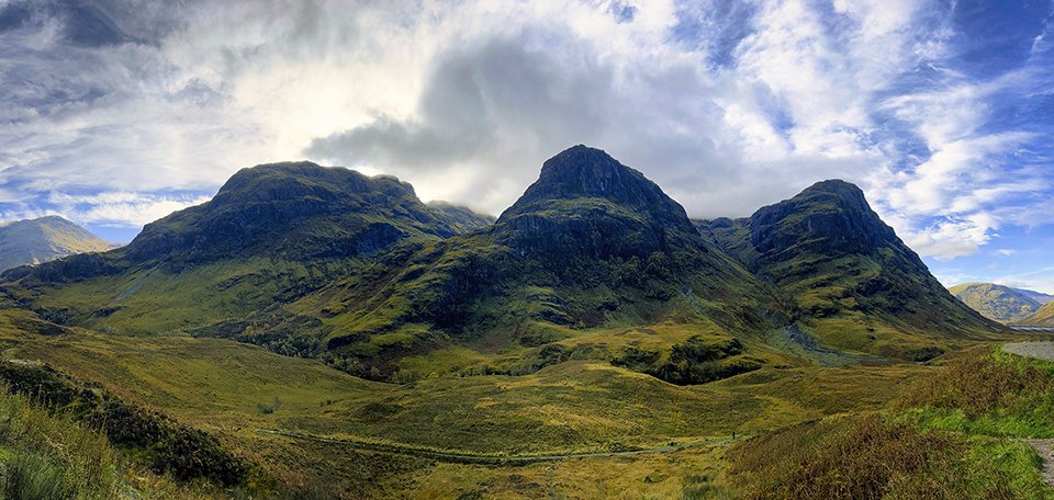
Continuing with our journey down route A82, we come to an impressive area known as the Three Sisters. A beautiful green valley abuts a series of imposing mountains, and I feel like this is a magical land out of a medieval storybook. The Three Sisters are known as Bidean nam Bian Mountain in Gaelic and have a yellow-brown appearance in October.

It’s getting later in the day, so we keep moving right along to an area known as The White House. It is quite overcast, but there is no precipitation. This scene is idyllic with small waterfalls in the foreground, the white house in the mid-ground, and mountains in the background. I get several different compositions and settle on one as shown here.

Our group leader, Don, says it’s time to pack it in. We head back to the bus, with one site left on the day’s itinerary. Some time passes, and we are not moving. There is no sign of Don, and the remaining daylight is starting to fade.

Eventually, Don returns to the bus to let us know that an incident has occurred. It turns out that a man who had parked his car next to the bus had hiked up the mountain with his eleven-year-old son and eight-year-old daughter.

The daughter suffers from asthma and began having an acute asthmatic attack. The father sent the son down the mountain to look for the daughter’s inhaler in the car. That was when Don found him rifling through the vehicle, with the inhalers nowhere in sight. The little boy was distraught!

Don comes on the bus to let us know that we will not be making it to the last site of the day. He turns his attention to me, a cardiologist, to get some medical advice on how to handle this situation. This is complicated. We can’t see the father and daughter up the mountain. Even if they were accessible, a full blown asthmatic attack would require inhalational bronchodilators and/or intravenous steroids.. My advice is to call 911 which is 999 in Scotland.

An ambulance is called, and the rig shows up in forty-five minutes. During this time, Barbara, one of the clients on this tour and a retired emergency room nurse, brings the boy on the bus. She keeps him occupied by asking questions about where he goes to school, has this happened to his sister before, does his family do a lot of hiking, etc.

Finally, we see the father carrying the daughter on his shoulders down the incline. He eventually makes it to the bus, and the ambulance driver takes over. I can see that the girl is wheezing, but probably will not need steroids, and does not need to be intubated.

We head back to the hotel and straight to the bar. This has been exhausting, but what was done was worthwhile. It’s obvious that despite being a photographer, I can never stop being a medical doctor. I hope tomorrow ends more smoothly!


The Callanish Stones

We’ve taken the ferry to the Isle of Lewis and Harris, and have gone to Seilebost Beach for our first set of photos of the day. It’s now on to the Callanish Stones for a late afternoon shoot. This is no small distance to get there, it’s very cloudy, and the remaining daylight will not last long.

Having arrived at this great marvel, all the photographers on our trip vie for position to gain a vantage point in which there is some spacing between the stones. The problem is, all our tripods are on top of each other, it has started drizzling, and the light is fading fast. After every shot, I have to wipe the camera lens with a special cloth and must shield the lens from raindrops with my umbrella.

This has become especially difficult, in that I’m experimenting with long exposures to streak the moving clouds.

The light is now gone, and I’m looking forward to getting warm and dry. We go back to our hotel, and I’m told that tomorrow afternoon we’ll return to this site to experience different lighting conditions.

We’re back at the Callanish Stones again the next day, and now I’m getting a new feel for the way this place looks. This stone circle is situated on a low ridge, overlooking Loch Roag. The hills in the distance are referred to as the Great Bernera. Thirteen stones form a circle, with a monolith appearing in the middle. All of the stones are composed of Lewisian gneiss, with the central structure standing 4.8 meters high.

The Callanish Stones were assembled between 2900 and 2600 BC. Archaeologists have found evidence that this area was part of a prehistoric field system dating from the late Bronze age to the early Iron Age. The Stones were estimated to have been abandoned around 800 BC and covered by a thick layer of turf. It was re-discovered in 1857 when the overlying layer of peat was removed.

It’s starting to get later in the day, and the light is changing rapidly. The sky is taking on a violet hue, really something to see. The appearance of this site is significantly different from that of the day before. Ron, one of the professionals, comes by to check my compositions. With his advice, I take some of the foregrounds out and leave more for the beautiful appearing sky.

He also suggests that I start shooting in manual mode, rather than aperture priority, for optimal control of my camera.

It is dark now, and we all pile back into the bus for the long ride back to the hotel. As I review my photos, I feel good about the great natural beauty that we’ve encountered in the Scottish Highlands. I’ve also gained some good photographic knowledge from Don, Ron, and Alex, the professionals. It’s time for a beer, dinner, and some needed sleep.

A Morning in Quiraing on the Isle of Sky, Scotland

Traveling with a group of photographers, I’m here on the Isle of Sky after crossing the bridge from the mainland on this October morning in 2022. This trip was originally set to go in 2020, but because of the Covid pandemic, was postponed 2 years in a row. I had been to the Scottish Highlands while backpacking in 1978 but did not see any of the gorgeous areas, including this one, that we will be taking in on this itinerary.

We’ve been in Scotland for 5 days now, and one thing I’ve learned is that going by weather forecasts around here is worthless. The weather is so variable, there can be extremes in short amounts of time. Our trip to Quiraing on the eastern face of Meall na Suiramach is a perfect example of this.

Our vehicle ascends a steep incline into a parking lot. There is a light rain outside, and I see the professional photographers zipping up their Goretex jumpsuits. I’m dressed in waterproof boots, ski pants, a fleece and a down jacket. This is water resistant, but not waterproof. What a mistake!

A long time ago, while learning photography, I was taught that if there is inclement weather with bad light, you might as well pack it in, and come back another day. However, I learned on this trip the fallacy of this thinking.

We proceed on a path on the Trotternish Ridge escarpment, with camera bag and tripod in toe. First, it’s raining, then sleeting, and a brisk wind is blowing. My down jacket is getting soaked. On a scale of one to ten, my misery level is about a seven. Nevertheless, we set up our tripods and start shooting. My first take appears above.

Wet and cold at this point, miraculously, the weather starts to change. The rain and sleet subside, and the wind is more manageable. I keep shooting, and it now looks like I came back on a different day.

Throughout millennia, the entire Trotternish Ridge was formed by a grand series of landslips. Amazingly, Quiraing is the only part that continues to move. The road at the base of this escarpment requires that repairs be made each year.

The name Quiraing is derived from Old Norse called Kvi Rand, or “Round Fold.” Legend has it that the fold was used to conceal cattle from Viking raiders.

We continue along the ridge, stopping at different vantage points. looking for the best light, experimenting with various compositions. I’m having a great time, even though my jacket is soaked, and I’m worried that the down will start settling near the bottom. Fingers crossed!

Shooting at Quiraing, I’ve learned a few things about photographing the Scottish Highlands. The concept that landscape photography is optimal on the edges of the day does not apply. With so many clouds, the light is even, and photos taken at noon will not look that much different from those taken early or late in the day. Secondly, do not bother with the weather forecasts on your phone app. Lastly, forget trying to get by with anything except a Goretex jacket around here!